

Ground Truthing, 2009
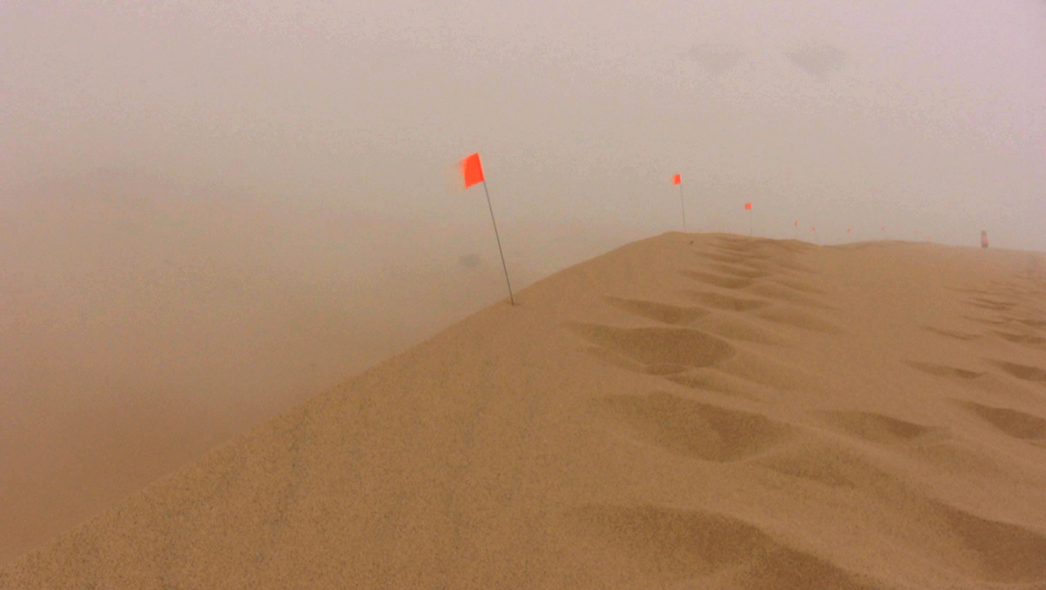
Ground Truthing is a project that investigates the intersections of technology, land use and the environment in the Guadalupe-Nipomo Dunes of California. Though saved by environmental activists from becoming home to a nuclear power plant, these dunes became the site of one of the largest and longest oil spills in US history, called “The Silent Spill”. Utilizing land surveying as a performative strategy, this mixed media installation seeks to examine the ways in which humans project onto the land particular values and ideals that both inhibit and embrace sustainability.
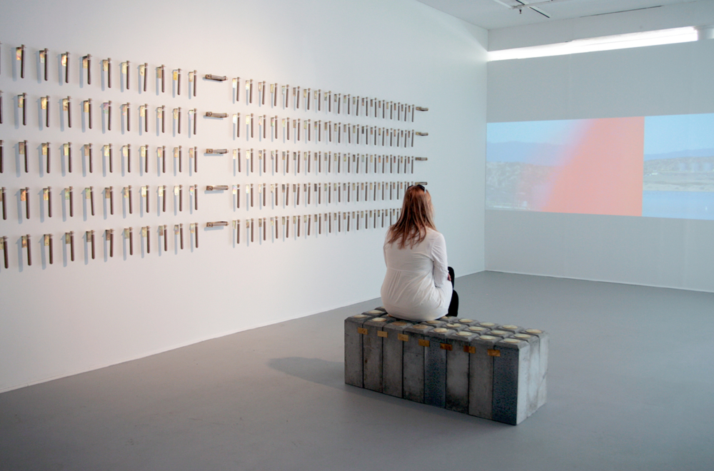
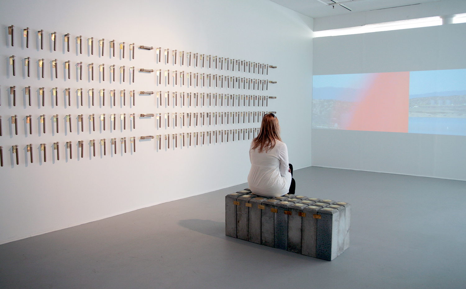
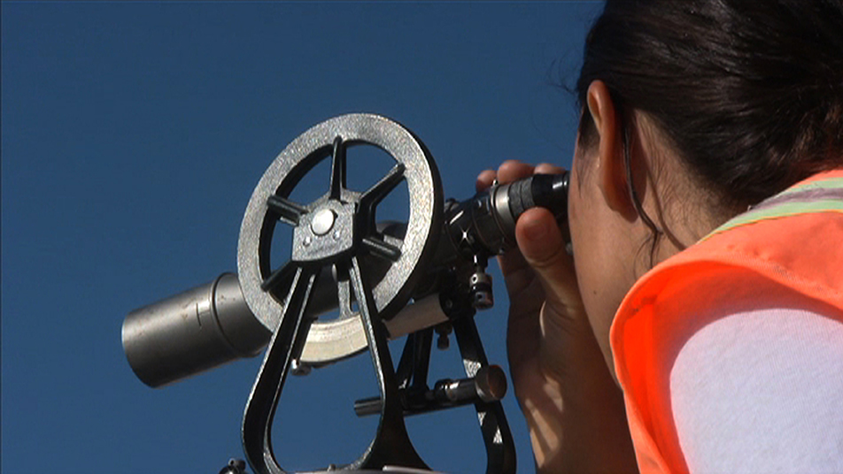
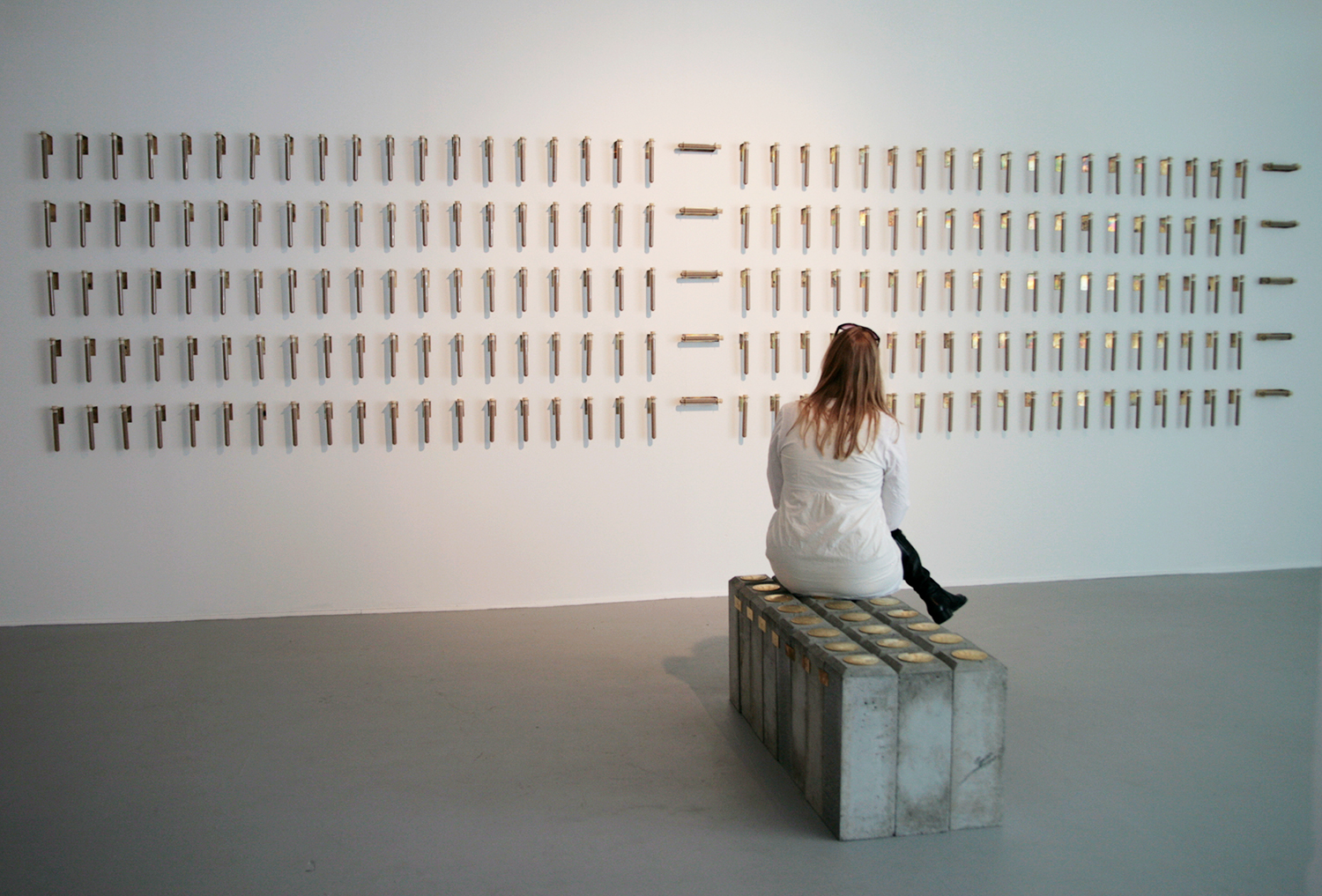
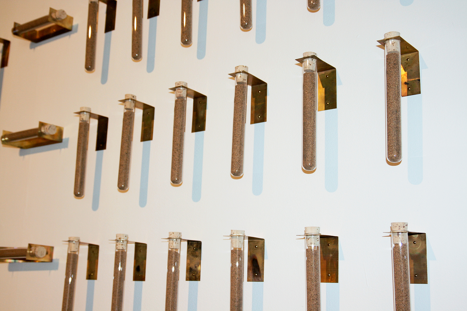
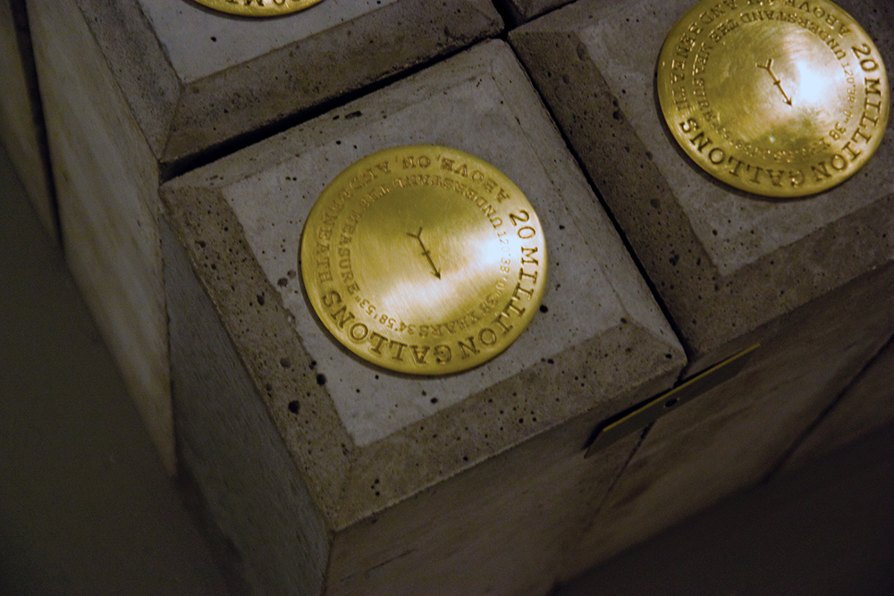
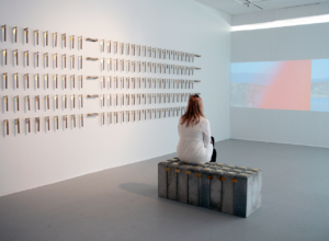
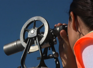
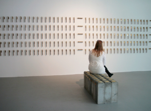
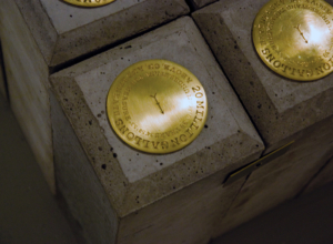
The project comprises a video projection, a wall installation and a bench. The panoramic video combines documentation of the cleanup with both real and fictitious surveying of the land. In the video, Geographic Information Systems (GIS) and other technologies are used in order to explore this landscape. The wall installation includes 200 test tubes filled with sand from the dunes. These test tubes reference the 1,100,000 tons of contaminated material currently being excavated and transported to a local landfill. The concrete bench is assembled from survey monuments or witness posts, which typically mark a permanent location in a particular site. In the installation they have been displaced in order to form a functional bench. Ground truthing is a technical term that refers to the activity of verifying remote sensing data collected through aerial photography and satellite imagery. Information is collected on site through surface observations and measurements in order to compare the pixel image with the real data of a location. In this project, I employ the concept of ground truthing and the technique of land surveying as a means for considering our relationship to technology and how our spatial perceptions change with these emerging technologies.
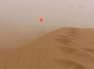
This “Silent Spill” lasted for approximately 38 years threatening not only animal life but also groundwater and surrounding agricultural lands. After over fourteen years restoration efforts continue. It is estimated that 1,100,000 tons of contaminated material will be excavated and transported to a local landfill before the cleanup is complete. Sand dunes represent a shifting topography – a moveable landscape where elevation and location are in constant flux. As a result, they defy typical methods of surveying and so force us to consider the impulse behind our desire to define, calculate and measure the earth. The American Congress on Surveying and Mapping defines surveying as “the science and art of making all essential measurements to determine the relative position of points and/or physical and cultural details above, on, or beneath the surface of the Earth, and to depict them in a usable form…” Based in my hometown, these dunes ask us to reconsider what is judged “essential” – above, on, and beneath the surface.